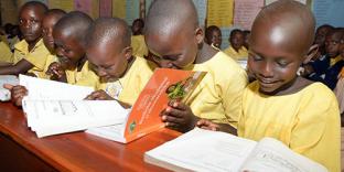
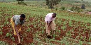
Kaberamaido District


Saturday, September 4, 2010 | Webmail
Kaberamaido at a Glance

Kaberamaido is one of the new districts in Uganda formed by a resolution of parliament in July 2001.

It covers an approximate total area of 1646 sq Km and lies at an approximate altitude between 1000m-1500m above sea level.

Vision
A healthy, educated and prosperous population by the year 2025.

Mission
To serve the community of Kaberamaido District through co-ordinated delivery of sustainable services focussed on national and local priorities in order to contribute towards the improvement of the quality of life of the population.

.... More

  Health

Mandate of the Health department
The department is mandated to ensure the attainment of a good standard of health by all people in the district in order to promote a healthy.... More

  Agriculture

Mandate of the Agriculture sector
The sector is mandated to increase agricultural productivity that ensures food security, improved household incomes and.... More

  Education

Kaberamaido attained its current District status in July, 2001 through an Act of Parliament. Formerly it was part of Soroti District whose main town; Solot attained the status of the headquarters of Teso region in 1912. This was as a result of being recommended by Sir Fredrick Johnson, following his appointment as the new Governor of Uganda.

Prior to its current District status, Kaberamaido had earlier been granted a District status following a pronouncement by the.... More

Mandate of the Education department

Government of Uganda Policy in this sector is to promote basic education by improving equitable.... More

 
© 2010 Kaberamaido District - Site by Uganda Home Pages